Wednesday, April 16, 2014

March 1-2, 2014 Storm Round-up

Overview
California's March 1-2, 2014 storm caused quite a stir up and down the coast from the San Francisco Bay area to San Diego. According to the National Weather Service report on the event, an intense low pressure system developed off the California coast and persisted from February 26 to March 2, 2014. The system produced heavy rain, strong winds, flooding, thunderstorms, damaging winds, small hail, and high surf. Orographic lift produced large rainfall in the Santa Cruz and Santa Lucia mountains. Offshore winds reached 55 mph and peaked at 71 mph along the mountains of the Big Sur coast.Coastal impacts were mainly felt in southern California due to unusually large wave exposure. The slow movement of the low pressure system, southerly track, and strong winds created a large fetch over the open waters of the Pacific which led to large wave heights impacting the coastline in otherwise sheltered areas reminiscent of El Nino-type storms.


The low pressure system, or extratropical cyclone, developing offshore on February 28.


The wave forecast was also quite formidable, with large offshore wave heights approaching 30 feet with a westerly angle of approach, according to Surfline.

Surfline's wave forecast showing offshore wave heights approaching 30 ft with a westerly swell.


I reviewed the National Data Buoy Center offshore wave measurements over the period from March 1-2, 2014 and pulled out the peak wave conditions over that time. As you can see, the highest offshore wave heights were along the San Luis Obsipo and Santa Barbara coastlines. This is consistent with the Surfline forecast shown above which shows the maximum wave heights off of Point Conception. Also of note is the predominant westerly direction of the buoy measurements, which generally show waves approaching from the W or WSW. Once you get into the southern California bight, the offshore islands start to play a role in determining which coastal areas were hardest hit, as the islands shelter some areas more than others.

Peak Offshore Wave Heights - March 1-2, 2014

Station ID
Station
Hs (m)
Hs (ft)
Tp (sec)
Dm (deg N)
46026
San Francisco
4.0
13.1
14
238
46114
Monterey
6.5
21.3
13
246
46239
Point Sur
7.1
23.3
14
252
46028
Cape San Martin
7.4
24.3
14
244
46011
Santa Maria
7.6
24.9
15
250
46218
Harvest Buoy
6.7
22.0
17
271
46054
West Santa Barbara
6.5
21.3
15
262
46216
Goleta Point
4.3
14.1
15
261
46217
Anacapa Passage
2.9
9.5
15
267
46221
Santa Monica Bay
4.5
14.8
11.5
262
46222
San Pedro
4.7
15.4
12.3
267
46223
Dana Point
3.0
9.8
10.3
268
46224
Oceanside Offshore
3.3
10.8
17
267
46225
Torrey Pines
4.4
14.4
11.2
282
46231
Mission Bay
4.2
13.8
15
274
46232
Point Loma South
4.9
16.1
17
275

Note: Hs = significant wave height, Tp = peak wave period, and Dm = mean wave direction


I won't focus too much on the precipitation impacts, other than to note that precipitation was widespread across the state and that there was a lot of it! The NWS precipitation totals are shown below. The highest rainfall totals in central California reached 10+ inches in the Big Sur Mountains and parts of southern California.


County Summaries
Santa Cruz
Santa Cruz County was the most northern county to feel significant impacts from the storm, primarily due to its southern exposure. In the City of Santa Cruz, large waves impacted the shoreline. Waves crashed up and over the breakwater at the Walton Lighthouse at the Twin Lakes harbor entrance.

Source: Central Coast Photographs

High runup was also observed from waves impacting the bluff at Lighthouse Point. The story has it this guy lost his board shortly after jumping in and had to swim back ashore.

Source: Allen Hughes Photography

Along West Cliff Drive, a 10x10 ft, 40-ft deep sinkhole opened up due to undermining by wave action on the bluff. The sidewalk was damaged due to the pressure of breaking waves forcing their way up into the cliff. One lane of traffic was closed while crews assessed the stability of the bluff.


Along the Santa Cruz Boardwalk, waves washed up onto the beach back to the seawall, but there were no reports of damage or overtopping.

Source: Sammy Garcia Photo

The Capitola waterfront, with its long history of flooding, probably saw the worst of the storm's impacts. Waves washed over the Esplanade seawall, reaching cars in the parking lot. Wave overwash combined with urban runoff to flood the downtown area businesses. Waves crashed into the deck of the restaurants at the Soquel River mouth, but business was reported to resume the next day.

Waves overtopping the Capitola Esplanade with evidence of earlier overtopping in the form of sand and debris on the sidewalk. (Source: Sabine Dukes)

Waves impacting the Venetian Hotel Condos seawall, with evidence of earlier wave overwash of the wall. (Source: Sabine Dukes)


Waves impacting the end of the Capitola Pier. (Source: Sabine Dukes)

San Luis Obispo
San Luis Obispo also experienced some dramatic wave action due to strong waves making their way around the breakwater and impacting the shoreline. At Port San Luis, waves washed over the revetment into the parking lot just north of the boat launch.


The folks at Avila Beach Paddlesports captured some great video of the wave overwash. Search "avila beach storm" on youtube for more videos.


Avila Pier was damaged and closed. Boards on the pier were lifted up from the waves during the morning high tide. Residents were quoted as saying they couldn't remember tides and waves this high.

Waves lifted up the boards along the Avila Pier, which closed during the storm. (Source: Laura Dickinson; http://www.sanluisobispo.com/)

At Pismo Beach, waves washed all the way back to the boardwalk and seawall. City personnel had to encourage folks to stay off the beach for safety reasons.
Waves inundate the beach at Pismo Beach (Source: Central Coast Pictures)
 
Santa Barbara
Santa Barbara County had some of the most dramatic stories come out of the storm event. According to the Santa Barbara harbor patrol, they experienced high tides in excess of 6 ft and waves up to 12 ft. Elsewhere, waves averaged 10-15 ft with crests up to 18 ft. At the Moby Dick restaurant on Stearns Wharf, a wave crashed through the window during breakfast:


Waves also inundated the beach surrounding the Santa Barbara Yacht Club and flooded the back beach area, depositing sand around the Yacht Club building and causing general chaos in the parking lot.


At Goleta Beach, waves crashed through the Beachside Bar and Cafe. A restaurant manager was washed out into the ocean and dislocated his shoulder (but made it back to shore!). The restaurant was flooded with seawater and the outdoor patio area was damaged. The Goleta Pier was pounded by waves and some planks were displaced. Three boats broke loose and washed ashore on the beach. The beach area was evacuated for safety reasons. News videos and photos of the storm damage suggested that water and sand washed into the parking lot.

At Goleta Beach, this sailboat washed ashore. (Source: Mike Eliason)

At Goleta Beach, waves washed up over the beach and into the lawn area. (Source: Martin Uhler; keyt.com)

At Gaviota State Beach, a 50-ft section of the pier was destroyed sometime before 830am on March 1. Waves were reported to be breaking over the top of the pier. Wave runup was reported to surge up the beach and into the parking lot and restrooms. On the beach, sand was eroded and exposed cobbles.

The end of the Gaviota Pier was destroyed during the storm (Source: Al Fimlaid; StandUp Paddle Sports)
Waves washed up and over the beach and into the parking lot at Gaviota State Park. (Source: Al Fimlaid; StandUp Paddle Sports)

Ventura
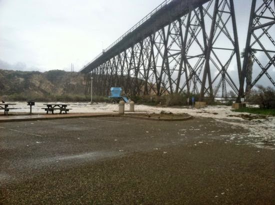
There were not too many reports of damage along the Ventura County shoreline. Some very large waves were documented at the Ventura Pier:

Source: Instagram (surferspointventura)
At the Point Mugu Naval Base, sand washed up and over an access roadway along Family Beach, inundating approximately 300 feet of the road along the Mugu Lagoon west spit and depositing approximately 6 inches of sand in some places.


Access road along Family Beach, Point Mugu. Source: Roberto Garcia (NAVAIR)

Orange
There were not too many reports of damage along the Orange County shoreline. At Newport Beach, a predicted tide of 6.25 ft reached 7 ft. Trucks were brought in to pump the storm drain system to keep the streets from flooding.

An oil platform offshore of Huntington Beach experienced some large waves but there were no reports of storm damage.

Huntington Beach Oil Platform (Source: Michael Latham)


Los Angeles
There was a fair amount of news out of Los Angeles in response to the storm. Large waves on the order of 8-12 ft were observed at Zuma Beach. Waves pushed past the concrete barriers along the back beach and into Parking Lot #4. Life guard towers had to be pulled back and the beach eroded 30-50 yards. In Malibu, at least one balcony stairwell was destroyed at a condo unit.

In Playa del Rey, a 200 ft bikepath was covered in a few inches of sand and debris and beach erosion was observed. The bikepath was also covered near Dockweiler State Beach.

Beach erosion at Playa del Rey (Source: Brad Graverson)

At Redondo Beach, the King Harbor Yacht Club was closed and harbor operations were interrupted on March 1. Waves on the order of 20-25 ft were reported to be hitting the breakwater. Overtopping waves created a surge in the harbor and ripped cleats off the docks and broke mooring lines. Several boats were moved to prevent breaking free from the docks. Waves washed over the wall into the parking lot. Damage was less than the January 1988 storm due to improvements to the breakwater following that storm event. 

Waves breaking over the King Harbor Breakwater in Redondo Beach (Source: http://www.brozaphoto.com/)


Surfers at Redondo Beach reported the swell to be the biggest in 31 years.


At Cabrillo Beach in San Pedro, waves rushed over the breakwater, causing significant beach erosion and sand overwash into the parking lot. In Long Beach, high surf breached a sand berm along East Ocean Blvd. Water caused minor damages in the garages and lower levels of about 20 homes between 66th and 72nd place near Alamitos Bay.
Waves impacting the San Pedro breakwater at the Port of Los Angeles (Source: http://www.michaeljusticephoto.com/)


San Diego
San Diego County also experience some flooding from the storm. At Imperial Beach, waves were 8-12 ft and sand and waves washed approximately 80 ft inland at the end of Palm Ave to the Spirit of Imperial Beach statue. Water flooded a condo garage on the north side of Cortez Street and waves were breaking offshore of the pier.

Flooding and sand deposited at the end of Palm Avenue in Imperial Beach (Source: Serge Dedina)
 
Evidence of wave overwash of the sand berm just north of the south jetty at 642 Ocean Lane apartments in Imperial Beach (Source: Serge Dedina)

In Coronado, city crews did not recall such high surf and tides in many years. Beach berms and sand stockpiles were reported to be successful in stemming the high tides. Much of the sand on the beach eroded though and sand berms needed to be replenished and rebuilt, particularly along South Beach.

If you have any photos or stories from the storm please let me know. I would love to include them in this post!

Sunday, February 2, 2014

To the edge of the Pacific Plate at Tomales Point

After seven years in the Bay Area, Allison and I finally made the trip out to Tomales Point, the long sliver of land separating Tomales Bay and the Pacific Ocean. What makes this location particularly unique is that it represents the tectonic boundary between the North American Plate (on the east side of Tomales Bay) and the Pacific Plate (on the west side of Tomales Bay). This chunk of land has moved northward approximately 90 miles over the last 50 to 60 million years, although its origins trace back even further to the Tehachapi Mountains in southern California.

Tomales Point is the northernmost point in Point Reyes National Seashore (photo source: California Coastal Records Project). The trail takes you all the way to the edge of the Point.

The hike starts at the end of Pierce Point Road at the Tomales Point Trailhead and continues approximately 4.5 miles out to the northern end of the point. The peninsula is flanked by water on three sides.


According to the National Park Service website, the Pierce Point Ranch was established in 1858 and was one of the most successful dairies of its time. The trail winds around the old ranch site before setting out for the ridge.

The old milking barn at Pierce Point Ranch.

The old milking barn at Pierce Point Ranch. Cows with a view!

We arrived around 1pm on a Saturday and the parking area was quite full. We encountered quite a few hikers on their return trip, but saw fewer and fewer as the day went on.

And we're off! The Tomales Point Trailhead.

A short distance along the trail we were greeted by sweeping views of the rocky cliffs on the Pacific side of the point.

The rocky cliffs of Tomales Point, with Bodega Head in the background.

On the other side of the peninsula, Tomales Bay was a little harder to see because the trail doesn't follow the high point of the ridge, but we were able to catch a few views to the east, including glimpses of Hog Island out in the middle of the bay.

View across Tomales Bay with Hog Island in the middle

For such a long hike, the trip was relatively moderate as the trail follows the flat plateau of the point. There are a few sections of up and down but overall nothing too steep.


After a couple miles we caught our first glimpse of the Tule Elk known to inhabit the area. I used my telephoto lens to snap a few pictures from afar. Little did we know, the elk would soon appear immediately adjacent to the trail, a little too close for comfort!


By the 1870s, the Tule Elk were all but extinct in California, supposedly reduced to a single breeding pair. Today, their population numbers in the thousands. These guys were trying to hide but we still managed to spot them somehow...


Some of the elk seemed to be quite nervous around us, while others paid no attention. The grass was so dry from the drought, I'm not sure what was left for these guys to eat!

Tule elk grazing with Tomales Bay in the background.

We continued out towards the point. The trail deteriorates a little bit and turns into a relatively easy to follow sandy path for the last half mile. This section of the hike was very exposed to the wind due to its northwest orientation.

View looking out to the end of Tomales Point, with Bodega Head in the distance.


At the end of the trail you can scramble down a little bit to the very edge of the cliff. To the north across Bodega Bay is Bodega Harbor, which is visible as a depression in the horizon caused by the San Andreas Fault. The bedrock outcrop at the base of the point appeared to be more erosion-resistant granitic rock with more erodible sandstone making up the upper receding portion of the bluff.

The edge of Tomales Point, with Bodega Head visible in the distance.

After a quick break for snacks we packed it up and headed back up the ridge. By this time, we were two of only a handful of folks still left on the trail. The elk seized upon the opportunity to take over the trail and blocked our path out!

Attempting to bypass the elk by traveling cross country just west of the main trail.

We skirted around to the side of the elk and made it about 100 yards before they spooked and headed off down the ridge.


 On our hike back we were treated to a stunning sunset view down the coast towards Point Reyes.

View of McClure's Beach from the Tomales Point trail on the return trip, with the Point Reyes beaches in the background.

We made it back to the car at dusk and explored the Pierce Point Ranch for a few minutes before packing up. Another successful day trip to the Point Reyes National Seashore. Tomales Point? Check!

Saturday, November 30, 2013

What is your flood risk tolerance?

I recently read an article in the December 2013 issue of Money magazine titled "After the Flood", which chronicled the financial difficulties of a Staten Island couple in the wake of Hurricane Sandy. Sandy made landfall on October 29, 2012 and when it was all said and done, caused $70 billion in damages across 24 states. The couple stayed put during the storm, which inundated their house up to the second floor and floated their cars several blocks down the street. Their home value decreased from $303,000 to $204,000 post-Sandy (likely due to flood damage and higher cost to insure) and they still owe $275,000 on their mortgage - putting them literally and figuratively underwater. Even worse for the couple (but perhaps better in the long term), new post-Sandy FEMA building standards will require the couple to elevate their home by 10 feet to place it above the new flood elevation - a very costly proposition which they cannot afford. These are the costs and risks of living in flood prone areas.


Predicted and observed tide levels at the Battery, NY during Hurricane Sandy. October 29, 2012 was the highest ever recorded tide at this location due to coincidence of high tide and peak storm surge.

The Money article provides more details on the financial struggles of the couple and the steps they are taking to get their lives back on track. The article got me thinking about our attitudes towards risk and the value we place on home ownership, even if we do live in disaster-prone, yet desirable, areas. This was highlighted the most clearly by the very last paragraph of the article, which noted:
Still, they're eager to move on and to finally be able to put Hurricane Sandy behind them. Says Motherway (the wife): "You just hope it's the kind of storm that happens only once every 100 years."
As an engineer, I consider flood risk from a statistical perspective and not one based on wishful thinking - if you live in a flood zone, you are playing the odds and betting that either: (1) you will not encounter a storm severe enough to flood you, (2) you have adequate insurance to cover your losses, or (3) the state and/or federal government will come to your aid in the event of a natural disaster. For example, if you live in a low-lying area behind a levee that provides 100-year flood protection, you are presumably protected from all less severe flood events (e.g., 10-year, 50-year, etc); however, for any storm more severe than a 100-year event, you will be flooded. That is a level of risk that many Americans live with every day. The problem with the terminology "the 100-year flood", as illustrated by the Staten Island couple's statement, is that it implies such a storm will occur only once every 100 years. More accurately stated, the 100-year flood is an event that has a 1% chance of occurrence in any individual year (the "1% annual chance" terminology is preferred by risk analysts). Over a very long period of time, this severity of storm will indeed occur, on average, once every 100 years, but over the short term it could occur more or less frequently. For example, during El Ninos in California, we can have back-to-back severe weather events (e.g., rain, water level, and wave) during a single winter storm season, separated by years of calmer conditions.

Using a statistical concept known as "encounter probability", we can estimate the likelihood of experiencing a storm of a particular severity over a specified time frame. For example, the commonly quoted statistic that the San Francisco Bay area has a 63% chance of experiencing a 6.7 magnitude earthquake or greater over the next 30 years is a type of encounter probability analysis. In terms of flooding, there is about a 25% chance that a homeowner will experience 100-year flooding or greater over the lifespan of a standard 30-year mortgage. Now, I don't know about you, but that seems like a pretty high likelihood to me! It's actually a bit frightening to think that our nation's flood protection infrastructure in any one location generally has a 25% chance of being overwhelmed by flood waters over such a short length of time. Using the concept of encounter probability, I produced a set of curves (shown below), which illustrates the likelihood of experiencing a storm of a given severity over a specified length of time. By selecting a storm severity curve and project lifespan, the likelihood of flooding (encounter probability) can be determined. For example, using the green curve below, there is an 80% chance of experiencing a 25-year flood or greater over a 40 year time span.

Encounter probability of an extreme storm event over a given duration.

FEMA's National Flood Insurance Program uses the 100-year floodplain as the standard to assess whether or not a homeowner is required to purchase flood insurance. Most mortgage companies require borrowers to purchase flood insurance to protect their loans until homeowners pay off their mortgages (after that, insurance is recommended, but not required). I calculated the encounter probabilities for storms of different severity over a standard 30-year mortgage period and a 75-year lifetime of a typical American (see table below). As you can see, the chances of experiencing a moderate to strong storm (say, 25 to 50-year event) over these time periods are quite high. For reference, I also estimated the encounter probability for two recent extreme storms - Hurricanes Katrina (300 to 400-year event) and Sandy (1,000 to 1,500-year event). Estimates of the exact frequency of these types of storms are uncertain given our relatively short period of record, which is why I show a range of likelihood. Based on these estimates, it seems fair to say that Hurricane Sandy was a "once in a lifetime" storm, whereas Hurricane Katrina, while rare, has a reasonable chance of recurrence (approximately 20%) during our lifetimes (especially considering the effects of climate change, which could increase sea levels and storm frequency and intensity - but that's another topic!).

Likelihood of flooding (encounter probability) for different storm severities over a 30-yr mortgage period and 75-yr lifetime:


Return Period
(yrs)
30-yr Mortgage
Encounter Probability
75-yr Lifetime
Encounter Probability
5
100%
100%
10
95%
100%
25
70%
95%
50
45%
78%
100
26%
53%
200
14%
31%
Katrina
7-10%
17-22%
Sandy
2-3%
5-7%

I polled my girlfriend, Allison, and her sister, Tina, to see what level of risk they would take on assuming a 30 year habitation in their home. Tina indicated she would assume a 20% risk of flooding (comparable to FEMA's acceptable risk level) and Allison would accept a 10% risk (on the order of a Katrina-type storm). I plotted those points on the figure below (blue and red triangles) and they roughly translate to the 125 and 300-year flood events, respectively. Personally, I would tolerate a much lower risk of flooding, probably more along the lines of 5% (a 600-year flood event). This indicates that all three of us would not feel comfortable owning property within FEMA's 100-year floodplain.

Personal risk tolerance relative to likelihood of flooding during a 30-year mortgage period.

So what is your risk tolerance? If you purchased a home in a river or coastal flood prone area, what likelihood of flooding would you accept? It's not a simple question - what other factors would you consider?


References:
Money Magazine
http://money.cnn.com/video/pf/2013/10/28/pf-superstorm-sandy-staten-island-home.moneymag/

Climate Central
http://www.climatecentral.org/news/sea-level-rise-has-already-doubled-risk-of-sandy-level-flooding-in-nyc-16434

Significance Magazine
http://www.significancemagazine.org/details/webexclusive/3004001/Hurricane-Sandy-a-look-back.html

The Lens
http://thelensnola.org/2013/11/05/armoring-overtopped-levees-against-erosion-and-collapse-will-grass-cut-it/